
RECENT ACQUISITIONS - 18th April
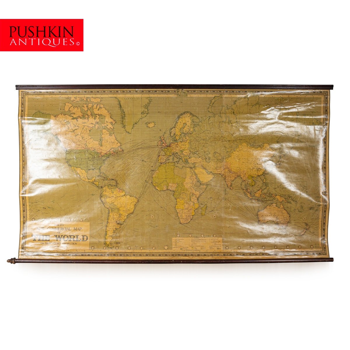
ANTIQUE 20th CENTURY LARGE SCROLLED MAP OF THE WORLD, GEORGE PHILIP & SON c.1918
Antique early-20th Century large commercial map of the world by George Philip & Son. This scrolled map shows shipping and timelines for transit. The map is in the equatorial scale of 1:20,000,000. This allows clear viewing of all the major ports and cities where boats could travel to both on the coast and inland via rivers and canals. Attached to the top and bottom, wooden scrolls allow the map to be unrolled and hung to the wall. A superb piece of history and ideal wall decoration for any library or office.
Reference Number: D10097